Thursday, September 5, 2013

Tropical Depression 7 Forms, Becomes Gabrielle

Tropical Storm Gabrielle Nearing Puerto Rico

T.S. Gabrielle this morning

The area of low pressure that I mentioned yesterday morning was declared  Depression Number Seven by late afternoon, and then upgraded to Tropical Storm Gabrielle late last night.

The center of the system is nearing the southeastern coast of Puerto Rico this morning.
The satellite image shown here may be a bit confusing until you realize you are actually looking at two systems.  The center of Gabrielle is actually somewhere off the southern coast of Puerto Rico.  The "blob of stuff" to her northeast is actually a separate area of  stormy low pressure (but not an organized system) which could possibly feed moisture into Gabrielle to aid in building convection.I say possibly, because I am not a weather expert, but it sure seems plausible to me.

Tropical Storm Gabrielle's vitals as of 8 o'clock EDT this morning:

LOCATION: 65 miles WSW of Ponce, P.R.
MAXIMUM SUSTAINED WINDS: 40 m.p.h., gusting to 50
MOVING:  Northwest at 8 m.p.h.
PRESSURE: 1008 mb, or 29.77 in.

Puerto Rico and the northeastern Dominican Republic are under a Tropical Storm Warning.  (No ships will be porting while this is the case)
The southeastern portion of the Dominican Republic has a Tropical Storm Watch.  Ports are likely closed there, too, at present.)

St. Croix has received heavy rainfall and some wind, as have some of the other Virgin Islands.

The center of the storm is expected to pass just east of the Turks and Caicos tomorrow, then head NNW, passing well to the east of Bermuda a few days later, if she holds together that long.  According the the experts there could be 'some strengthening' today and tomorrow.

Some cruise ships may alter their itineraries to ensure everyone's safety, and / or due to port closures.

As always with the tropics, things can and do change, so keep an eye on the NHC's  Public Advisory, issued every three hours when a system is near land, and every six hours otherwise.

UPDATE:   At the 11 am advisory, the NHC has downgraded this system to a Tropical Depression.   However, heavy rains and TropicaL Storm force winds are still expected today in the area including Puerto Rico and some of the Virgin Islands.

Wednesday, September 4, 2013

Blustery Weather for Carribean Cruising?

Tropical Low May Dampen Some Cruises

Image courtesy NOAA and the NHC
Cruisers to the northern Lesser Antilles, as well as Puerto Rico, the Dominican Republic, and possibly  Labadee,  and the Turks and Caicos might encounter a bit of wind and ran today and for two or three more days, due to a low pressure system moving through the area.

The latest computer models forecast it to turn north before making it into the Central Caribbean, moving towards the general vicinity of Bermuda later on.

As of this morning, the National Hurricane Center has given the system a 40 percent probability of strengthening into a tropical cyclone over the next two days, and a 60 % chance of doing so within five days time.  A tropical cyclone is an organized storm system of Tropical Depression strength or greater.

While chances of it becoming a named storm (the next stronger step after a Tropical Depression) are nebulous at this point, should it manage to do this, it would be called Gabrielle.

Some related pages:
2013 Hurricane Names
2013 Hurricane Season Predictions
Ten Tips for Cruising in Hurricane Season

Keep an eye on the tropics, folks - it's that time of year!

Monday, August 12, 2013

Updated 2013 Hurricane Season Predictions

Latest Forecasts by CSU and TSR

- from 2013 Atlantic Basin Hurricane Predictions -
Hurricane Felix (2007) passes Aruba, CC
The August updates for the 2013 hurricane season predictions have been released by two prominent forecasting teams:  Colorado State University, and Tropical Storm Risk.  Each has actually lowered their numbers, but only very slightly.

For years, those who follow seasonal tropical weather activity have followed the reports from the eminent team of Drs. FGray and Klotzbach at CSU.  Their original report, from April of this year, called for 18 named storms, 9 of which would become hurricanes, with 4 of those intensifying to major status.  The August forecast has revised that prediction to 18,8, and 3.

At TSR, the April numbers of 15.2 (named), 7.5(hurricanes), and 3.4 (major hurricanes) have also been lowered slightly in August, to 14.8, 6.9, and 3.0.

That's the good news.
The bad news is in the landfall predicions.  The brains at the two places generally agree that the chances of at least one hurricane hurricane making landfall somewhere in the U.S., and also at least one on the Caribbean are above average.  (That's as compared to the average year over the last century)

Here's where you can see more about this year's forecasts, and compare the numbers from CSU and TSR, as well as the NHC and WSI:   2013 Atlantic Basin Hurricane Predictions

How are we doing so far?
So far, we have seen four named storms, which puts us ahead of schedule compared to a typical year.  None of those four ever made it to hurricane status, making this year to date normal in that respect.

The next name on the list is:  Erin. (See all the hurricane names for 2013)

REMINDER:  Make sure your hurricane supplies are in order and that your emergency evacuation plans are up to date.  Don't forget the fresh batteries for your NOAA Weather Radio.


Friday, May 18, 2012

Hurricane Season Begins Soon

Hurricane Season is Nearly Here

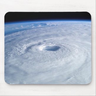
Hurricane from Space Mousepad
by Modest_Mouse


The 2012 Atlantic Basin Hurricane Season begins two weeks from today. 

Are you ready?

Hurricane season each year is from June 1 through November 30 for the Atlantic Basin, which includes the Atlantic Ocean, the Caribbean Sea, and the Gulf of Mexico.

REMINDER
If you haven't done so already, it's time to check your hurricane supplies.  Make sure you have enough batteries and other items to last for an absolute minimum of three days, and that you have a go bag ready in case you need to evacuate.  Don't forget about a supply of prescription medicines, copies of important papers, and evacuation provisions for pets.

Here are a couple of things to look at as the season approaches, if you don't have them already.  One is an absolute necessity and the other is something I've found really useful.  Here are links to reviews I've written about each of them:

Weather Alert Radio - a Necessity
If you live in an area that could be threatened by a hurricane, a NOAA weather radio is something you absolutely should have. These radios pick up special alerts from the National Weather Service, and will wake you with a warning of an incoming emergency.
Battery Organizer and Tester - Nice to Have
This isn't a real must have, but it sure is nice for keeping your battery supply both organized and handy, something that will make things just a little easier in the event of a prolonged power outage.

Thursday, July 1, 2010

Carnival Ecstasy still at Sea (Alex) Next Sailing Delayed

Because of severe weather from Alex, the Carnival Ecstasy has been unable to  port at Galveston.    Carnival Cruise Line has announced the following change.

The next cruise will now be a 3 day cruise to nowhere beginning on Friday, July 2nd.  Bording will begin at 2 pm.

According to the Carnival website, "Guests that sail on the new 3 day cruise will receive a 25% refund of their cruise fare along with a 25% discount on a future 3 to 5 day cruise departing prior to April 30, 2012 as well as a $25 per person on board credit as a reimbursement for the Cozumel government taxes and fees." 
SOURCE: http://www.carnival.com/cms/faq/default.aspx#q-1

This announcement brought to you by

Wednesday, June 30, 2010

Hurricane Alex

Tiki bar at Cozumel on a beautiful day.
Some cruisers encountered less than ideal weather in Cozumel last week, courtesy of then Tropical Storm Alex.

Well the 2010 Hurricane Season is off to a rip-roaring start in the Atlantic Basin.  Alex was upgraded to a hurricane last night, and, while he's still a Category 1, he's a big boy in terms of size.  He also has a very low minimum central pressure, so additional strengthening is certainly possible before landfall on the western gulf coast.  He's slowed down, and that can make him even more dangerous for wherever he strikes... and for a wide surrounding area, given his size.
There was minimal disruption in cruise itineraries as TS Alex came near Cozumel. Just one ship headed east to Nasau in leiu of Cozumel, and two others simply  reversed their scheduled port calls. 

Today's  turn-around for the Ecstasy could have been be affected, but the storm was considerate enough to move in time for the port of Galveston to be out of the danger area for the ship to return.  (Passengers may well have experienced the effects of some higher than normal seas, though.)  Let's hope he's equally considerate to the residents of northern Mexico and lower Texas.

June hurricanes aren't common, but aren't unheard of, either.  The season has just begun, so aware that your cruise between now and late November  could be affected this year, which is predicted to be unusually active.    Check my previous blog entry, Cruising During Hurricane Season for some basic tips.

This blog entry sponsored by

Friday, June 25, 2010

The SEASON Has Started!

Within the last hour the National Hurricane Center announced the formation the first Tropical Depression of the 2010 Atlantic Basin Hurricane Season. TD 01 is on the move in the Western Caribbean, and is expected to become Tropical Storm Alex before assaulting the east coast of the Yucatan late tomorrow.

After crossing the penninsula, it is forecast to emerge into the western Gulf of Mexico as a weaker system. However, the contidions there will be favorable for restrengthening. The water is warm, warm, warm in the GOM, and tropical systems just LOVE warm water.

In the Pacific, not one but TWO hurricanes currently churn well away from land. Celia has alreaady reached Category Five status, and is backing off, while Darby is also now a major 'cane at Categoroy Three. I hadn't blogged about this activity before, since neither has been a threat to land... but they certainly deserve a mention now.

Stay safe,, everyone, and keep your eyes on the Caribbean, as things have certainly cranked up early - just 25 days into the 2010 season.

More on the tropics later.
This tropical weather watch brought to you by

Friday, June 11, 2010

Cruising during Hurricane Season

Well, here we are, with 10 days of this year's Atlantic Basin Hurricane Season already gone, and not a storm in sight. That's typical, actually. The most active period is usually from about the second week of August through Octoer.

With virtually all of the major prediction centers and experts forecasting an extremely active season, we should be prepared for just about anything this year. Check your emergency plans, and get your 'go bag' ready if you live in a vunerable area. SOONER is better than later!

CRUISING
If you choose to cruise this time of year, here are some 'starter' tips for cruising during hurricane season from my Cruising Tips for New Cruisers page at Cruise Ready Store.
You may even find rough seas in the ship's pool during hurricane season.
Special Notes on Cruising during Hurricane Season
Hurricane season: June 1 – November 30

There are deals to be had during ‘the season,’ most especially during the peak months of August, September, and October. However, be prepared for possible trade-offs for those cheaper fares.


First – Plan to arrive at your port city at least a day early. If there’s an active ‘cane, the port authority could close down the port and order all ships to sea hours early. The captain has no choice... the ship MUST leave - with you or without you.

Second – Always buy travel insurance.

Third – Never cruise the Caribbean during hurricane season with your heart set on seeing a particular port. The captain WILL divert the ship’s course to keep you safe. This may include substituting an alternate port, or missing one or more ports entirely.

Fourth – Be prepared to end your cruise a day earlier or later than scheduled, or even in a different port than originally planned. Make return travel arrangements to your home that can be adjusted accordingly.

Fifth – If you are prone to motioin sickness, take along plenty of your favoirte remedy. Our favorites are of the natural variety, like these ginger candies.


Yes, all of the things mentioned above can happen. Not often, but they do. We cruise during hurricane season. We have even cruised in the rough seas generated by a Category 3 hurricane. And yes, we've been on a ship that was ordered out of port a few hours early, and arrived back a day late - at a port 200 miles from the one we left from. And yes, we had a wonderful time. Just wish we'd come home to a house with electrical power, and a neighborhood with gas stations and grocery stores that were open and stocked with inventory. But, we were well able to deal with it all, having just enjoyed some time on board our favorite cruise ship.

So, if you are cruising during hurricane season, be sure your home will be ready, and then get ready to cruise... Be sure to visit CruiseReadyStore.com and Cruise Ready on Zazzle to find some great cruise gear. You'll also find more tips and discussions about cruising during the season at http://www.cruiselinefans.com/.

Saturday, May 1, 2010

2010 Hurricane Season Approaches

The 2010 Atlantic Basin Hurricane Season begins in 31 days, on June 1. And, it's only 15 days until the official start of the EPAC (Eastern Pacific) season. As usual, Cruising Musings will be keeping an eye on the tropics.

Several hurricane experts have weighed in with their predictions for this year's tropical activity, and there is a general agreement among all of them that the 2010 season is very likely to be more active than that of 2009. At this point, the general consensus is that this season will be well above average, with the following ranges predicted among those from CSU, WSI, TSR, and Accuweather:

Number of Named Storms: 16 - 18
Number of Hurricanes: 7 - 9
Number of Intense Hurricanes: 4 - 5 (Category 3 or stronger)

There's a general agreement that the threat of at least one landfalling hurricane for the US coast (Atlantic and/or Gulf), as well as in the Caribbean, is greater than average. One organization (WSI) even pegs the probability that 2010 will be in the top 1/3 of most active seasons on record at a whopping 77%!

Whether you have a ton of faith in these early predictions or not, given the fact that we are in an active multi-year cycle, it's not unreasonable for coastal and island residents to be a little more prepared than usual. Last year was an easy one. What are the odds of two in a row during an active cycle?

Yep - it's that time of year: Time to be giving some serious and active thought to your emergency plans, supplies, and preparations.