Tuesday, July 30, 2013

Remnants of Dorian Bringing Squally Weather

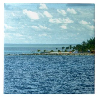
Dorian's Remnants Moving Through Turks and Caicos, Bahamas


Image Courtesy NOAA

Tropical Storm Dorian is no more, but his remnants are still around... the Turks and Caicos are getting squally weather today.


Tomorrow, and into Thursday, those squalls will move into The Bahamas.
Bahamian cruises may experience some less than sunny skies.

But, it couild have been worse.  Dorian never became a hurricane, but if he had, he would have teen one of those long tracking Cape Verde Hurricanes that we usually start seeing in very late July or early August.

The appearance of Dorian marked the beginning of the Cape Verde hurricane season.  That means it's the time of year residents living along the East and Gulf coasts of the U.S., as well as those in the islands, to turn their eyes way east, and watch those waves coming off the coast of Africa.

Cruisers, too, if you are worried about the possibility of a tropical weather system having an impact on your cruise vacation anywhere in the Atlantic Hurricane Basin.

Friday, July 26, 2013

St. Kitts Becoming a More Popular Cruise Port

Someone is Doing Something Right

Coastline St. Kitts Stretched Canvas Print 
by danitadelimont 

St. Kitts and Nevis, in the Leeward Islands, is a cruise destination that intrigues me.  Apparently, I'm not alone. According to an article called St. Kitts and Nevis enjoys hotel, cruise ship bonanza, posted this week by the Baltimore Post-Examiner, it's one of the " highest-rated Caribbean destinations for cruise tourism expenditures and passenger satisfaction."

The above article, which is worth a read, cites a study by a Pennsylvania based research organization that says there has been an astonishing 400% increase in the number of cruisers visiting there since 2006.

Perhaps even more significant was that the average per passenger expenditures almost doubled in the same period.  Obviously, somebody down there is doing something right!  (Maybe other tourist destinations need to take a lesson or two.)

I've enjoyed cruise ship port of call visits to some of the nation's Caribbean neighbors, including St. Thomas, St. Maarten, St. John, Antigua, Barbados, and St. Lucia.  But St. Kitts is still on my bucket list.

A while back, my curiosity about the place led me to create a page, called Pictures of St. Kitts and Nevis, as a sort of on line 'places to go' reminder to myself and others.   Now, after reading the Post-Examiner article,  I'm even more intrigued.


Wednesday, July 24, 2013

Tropical Storm Dorian

Tropical Storm Dorian Forms in the Atlantic

 Cone from the N.H.C.

The fourth named storm of the 2013 hurricane season has formed out in the tropical Atlantic.  It's name is Dorian, which is the replacement name for the retired Dean.  Let's hope Dorian doesn't have aspirations of following in his footsteps.  Dean was a killer, destroying a town (Majahual) on the Yucatan Peninsula, and leaving 45 dead across the Caribbean and Mexico.

Fortunately, Dorian is not projected to become another Dean, in spite of the fact that they both are Cape Verde storms.  At this point, the NHC is forecasting Dorian to be 'only' a tropical storm in five days when the system reaches the Antilles.  Conditions in the Atlantic are not expected to be terribly conducive to a great amount of intensification.  The storm will have dry air and wind sheer to fight on its trip westward.

This morning, maximum sustained winds are 50 mph, and movement is to the West of Northwest.

Still, those planning on cruising traveling to the Virgin Islands or Puerto Rico this weekend or early next week should keep a wary eye on the tropics, and be ready to adjust plans accordingly.

To our friends who live in the islands - prepare, and be safe!

Where Dorian will go beyond that (if anywhere) is still anyone's guess, so those who live in hurricane country - you know the drill:  Check your hurricane supplies and stay informed!


Saturday, July 20, 2013

Sailing from Port Canaveral? See Atlantis While You're There!

See Space Shuttle Atlantis

By Kitch  [CC-BY-SA-3.0 (http://creativecommons.org/licenses/by-sa/3.0)],
via Wikimedia Commons
If you're planning on cruising out of Port Canaveral any time soon, why not come a day or two early, and see NASA's new Space Shuttle Atlantis Exhibit at at the Kennedy Space Center Visitor's Complex?

The visitor complex is convenient to the port, so if you stay at a Port Canaveral hotel, you won't have far to go.  (You can actually see the Vehicle Assembly Building from the decks of the ships when they are in port.)

The exhibit is a new one, having been open for only about a month.  There's plenty else to see at the space center, too.  You'll no doubt be awed by some of the things you'll see, not the least of which is the last shuttle to make a trip into space.

There's also the Rocket Garden, a couple of impressive IMAX movies, several different bus tours of the facilities to choose from, and even the opportunity to have lunch with a real astronaut!  (Visit the KSC Visitor Complex website to get tickets and find out what else there is to see.)

And, if you're wondering where Atlantis got its name, here's a hint:  It was NOT named after the mythical lost city.

A space center tour is just one of the things that you can do in and around Port Canaveral before or after your cruise.  It's one that will be long remembered by both kids and adults.


Tuesday, July 9, 2013

Tropical Storm Chantal heads for the Caribbean 

Tropical Storm Chantal on the Morning of 07/09/13
Courtesy NOAA

Looks like, just as the 2013 Hurricane Season Predictions indicated would happen, the tropics are starting to crank.

This morning, Chantal, the third named storm of the year, is working her way into the warm open waters of the Caribbean Sea.    Clipping along at some 23 knots, she'll be there shortly.  Early reports indicate she has had relatively mild effects on Barbados and St.Lucia so far this morning, but that winds in Martinique have been stronger.

The highest winds found by Hurricane Hunters have been around 60 mph, but thankfully, so far, the ones that have made their way onto the Windward Islands have been less severe.  They still have a bit of Chantal to endure, however.

Once she hits the open waters of the eastern Caribbean, the story could change.  The system is forecast to strengthen before arriving at the shores of Hispaniola sometime tomorrow.  That is where she could possibly do her first real damage.

Keep a careful eye on the path she takes over the Dominican Republic and/or Haiti.  If she goes over the more mountainous area, we could see a far weaker Chantal on her arrival in the southeastern Bahamas than we would if she travels over the flatter eastern part of the D.R.

Nevertheless, if you're in The Bahamas or on the east coast of the U.S., keep an eye on her.   Most of eastern Florida is already in the cone at this point.

And, for my cruising friends, if you're sailing out of Florida this weekend, PLEASE do yourself a favor, and arrange to arrive at your city of departure at least a day early.  An approaching storm could force a change in your ship's schedule.  (See Ten Tips for Cruising in Hurricane Season for more on that.)